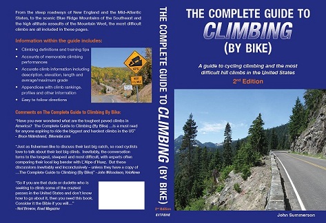
The Complete Guide to Climbing (by Bike)
2nd Edition!
Introduction
Road bike cycling is one of the most popular sports in the world and the biggest challenge within the sport, and its most intriguing aspect, is hill climbing. Major professional cycling tours such as the Tour de France are usually won and lost in the mountains. Cycling greats such as Eddy Merckx, Bernard Hinault and Lance Armstrong, while very complete all-around riders, became legends in the sport in large part from their climbing exploits. The mountains add an almost mythic quality to races as the riders are seen overcoming obstacles that extend beyond the actual asphalt, rock and dirt upon which they climb. Even average cyclists feel the allure of attempting difficult climbs and achieve tremendous satisfaction from a successful summit....
Climbing
....The performances of great early climbers such as Alfredo Binda, Fausto Coppi and Charley Gaul continued to increase the popularity of the major tours. These events made climbs such as the Tourmalet and L’Alpe d’Huez in France and Stelvio in Italy as well known to cycling fans as the Daytona Speedway or Yankee Stadium are to U.S. racing and baseball fans respectively. The mountains allowed bike races to become truly great as the event rose beyond the personal concerns of the cyclists to reflect life as a whole. Today hill climbing is more popular than ever and within multi-stage races those with hilltop finishes are usually the most anticipated and best attended stages of the race. Racing fans know that hills offer the best opportunity to view the drama within the peloton as it struggles through the most difficult and important element in any race. Climbing adds the mythic quality of overcoming obstacles that continues to be associated with the major cycling tours and which has produced many memorable moments. Ascending difficult hills is about struggle and perseverance and it is these aspects that have made conquering the mountains the heart and soul of cycling.
About This Guidebook
Europe is generally considered to be the epicenter of climbing by bike and that reputation is well-deserved. Full of very steep roads often laid down before regular auto traffic was used on them, Europe does contain many difficult hill climbs along with having the distinction of being home to most of the major cycling tours. Because of this many climbs there are well known; not only to professional riders but also to the legions of amateur cyclists on the continent. As there are few major stage races in the United States, many of the best climbs are relatively unknown. However, the U.S. has a wide variety of climbs comparable to the most difficult used in the major European Tours. Whiteface Mountain in New York for example is almost identical in length and grade (steepness) to the famous French climb of L’Alpe d’Huez, one that is often a stage finish in the Tour de France and considered among the toughest used in that race. Others such as Whitney Portal in California and Mount Equinox in Vermont are even more difficult. Owens Valley in California may have more beyond category (the most difficult classification) climbs within its walls than any location on earth. Nearby Death Valley has multiple category 1 (the second most difficult classification) climbs by itself. There are many climbs with over 5,000 feet of vertical elevation gain, and others that top out in the rarified air above 10,000 feet, including the highest paved road outside of the Andes and Himalayan Mountains. The U.S. also has a select group of climbs that are among the most difficult in the world including Onion Valley Road in California, several Hawaiian giants, unique in that they gain up to and beyond 10,000 vertical feet of continuous climbing, and the incomparable Mount Washington in New Hampshire, which may be the toughest of them all...
Back Cover
Avid cyclists know that hill climbing is the crux of the sport. Getting up cycling’s brutal slopes is often what separates average from elite riders. However, accurate information on this cycling sub-specialty has been lacking, particularly the location and profiling of the great American climbs, which rival the major European professional tours’ best. This situation has now been rectified as this guidebook provides cycling peak-baggers with everything they need to know; from how best to prepare to get to the top of the mountain to the most difficult climbs in the U.S. From the incredibly steep roadways of New England, to the scenic Blue Ridge Mountains of the Southeast and the high altitude assaults of the mountain west, the most difficult climbs are all included in these pages. Information within the guide includes:
• Climbing training tips
• Accounts of memorable climbing performances
• Easy to read directions with maps
• Descriptions and accurate climb information including total elevation, length and average/maximum grade
• Appendices with climb rankings and other information
• Climb profiles
Select United States Climbs:
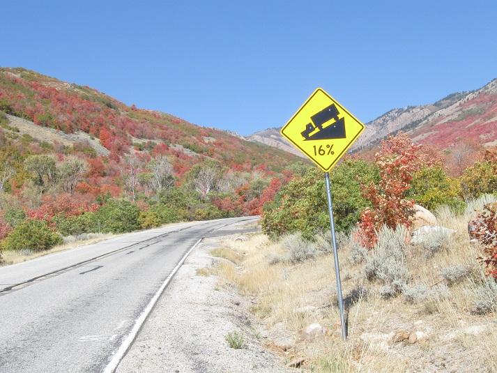
Powder Mountain, Utah
______________________________________________
Total elevation - 3,179 ft Length - 6.0 miles
Average Grade - 10.0% (17%) Rating - 3.69 (hors)
______________________________________________
A monster climb, Powder Mountain will slam you along long stretches of double digit grade over its 2nd half. In fact, it may contain the most difficult finish of any U.S hill. A tale of two climbs in a sense, its start is along moderate grade through a mountain neighborhood. Soon however, as the houses recede, the grade rears up and bites you. The road enters a narrow canyon and the slope goes ballistic. Hitting double digit for almost all of the remainder of the ascent, the last 3 miles of this one average over 13% grade. Near the top the slope eases just a bit and the climb ends as the pavement ends at a ski area. Powder Mountain may be the fastest descent in the U.S. as well.
Directions - From Eden, UT near Ogden head north on Route 162 for a short distance to a 4 way stop (Routes 162 and 158). From that junction head east on Route 158 (toward Wolf Creek) for 1.2 miles to Willowbrook Lane on the left to begin the listed climb.
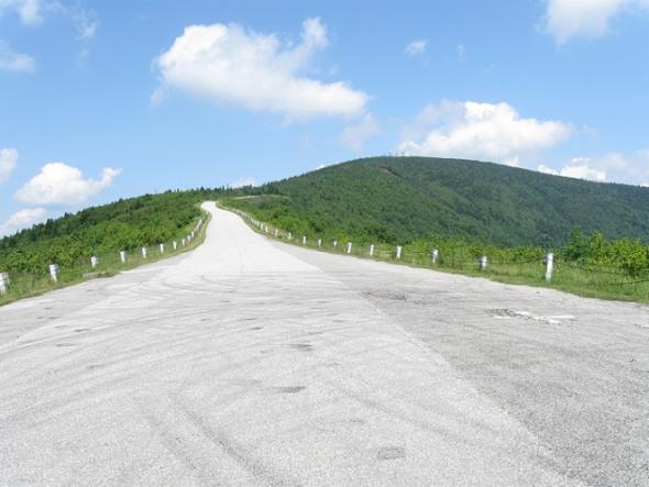
Mount Equinox, Vermont
_______________________________________________
Total elevation - 3,157 ft Length - 5.2 miles
Average Grade - 11.5% (17%) Rating - 3.89 (hors)
_______________________________________________
Mount Equinox in southwest Vermont is one of the most difficult climbs on earth. Unfortunately it is open to bikes only during the annual race on its slopes. Steep from the start, multiple ramps of 9-12% greet you as you begin up the hill, soon to ride within woods. Within its 2nd mile you encounter a short flat and then a small descent. Soon however the evil side of Equinox returns as you run into an extended double digit ramp that contains the maximum grade on the hill. A few tight switchbacks carry you higher up the mountain. After what seems like an eternity, the road opens up just over 4 miles in as the grade eases as you ride along a hogback with views. From here the grade slowly ramps back up to double digit as the trees close in again along with switchbacks. A final straight section of torture brings you to climb's end at a small parking area.
Directions - From Manchester, VT, head south on Route 7 for several miles. The Mount Equinox toll road will be on your right and the listed climb begins just beyond the toll gate.
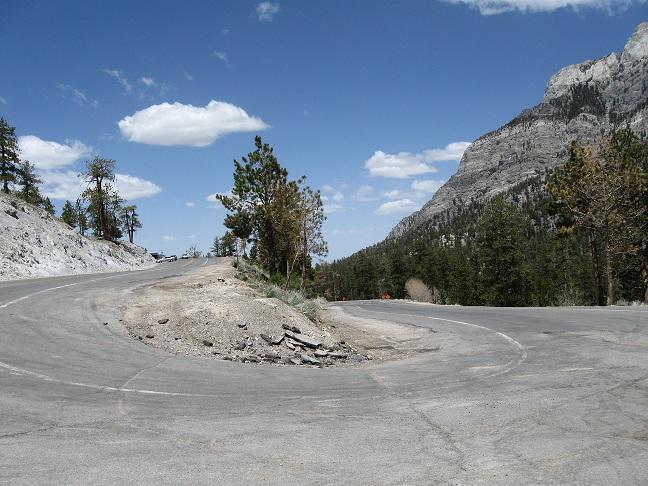
Lee Canyon, Nevada
_________________________________________________________
Total elevation - 5,348 ft Length - 17.3 miles
Average Grade - 5.9% (9%) Rating - 3.57 (hors)
_________________________________________________________
One of the most difficult climbs in the United States and perhaps the most difficult in Nevada, Lee Canyon (Route 156) pulls away from Highway 95 within a wide valley. The grade is moderate and there are views of big mountains in front of you. As you ride west the grade remains fairly steady and you are exposed to the sun. Beyond 10 miles of climbing the road begins to twist a bit which is a welcome break. Soon the only descent on the hill appears and it is stout but short. Climbing then resumes over moderate grade. Continue straight at the junction with Route 158 on the left. The grade eases a bit here and a few signs of civilization begin to appears as you begin to ride through stands of big trees and with sharp mountain peaks in front of you. Near the very top are a few switchbacks and the climb ends where the pavement ends at a small parking area for a ski station. Hang on for the descent of Lee Canyon as it is one of the quickest in the US.
Directions - From Las Vegas, NV head north on Route 95, shortly passing the road to Kyle Canyon on the left. From this junction continue north on 9 for ~14 miles to Route 156 (left) where the climb begins.